- Created: August 18, 2023 2:52 pm
- Updated: November 12, 2023 10:22 pm
- Distance Instructions
- Distance 12 miles
- Time 44 min
- Speed 17 mph
- Min altitude 6355 ft
- Peak 9380 ft
- Climb 686 ft
- Descent 3711 ft

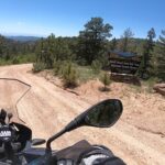
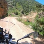
Shelf road is a dirt road that runs from Cripple Creek down to highway 9 and eventually to Canon City, CO. The road starts off pretty tame but eventually has some elevation changes, gets moderately rocky and includes shelf action through canyons with several steep drop offs. One should definitely have a dirt capable motorcycle with experienced rider to tackle this route. Of note, there is a sign at the beginning of the route that suggests that only high clearance vehicles and 4x4's should attempt this but an adventure type bike will be just fine.
1. Shelf Road
Cripple Creek is a statutory city that is the county seat of Teller County, Colorado, United States. The city population was 1,155 at the 2020 United States Census. Cripple Creek is a former gold mining camp located 20 miles (32 km) southwest of Colorado Springs near the base of Pikes Peak. The Cripple Creek Historic District, which received National Historic Landmark status in 1961, includes part or all of the city and the surrounding area. The city is now a part of the Colorado Springs, CO Metropolitan Statistical Area and the Front Range Urban Corridor.
Source: Wikipedia

Shelf road is a dirt road that runs from Cripple Creek down to highway 9 and eventually to Canon City, CO. The road starts off pretty tame but eventually has some elevation changes, gets moderately rocky and includes shelf action through canyons with several steep drop offs. One should definitely have a dirt capable motorcycle with experienced rider to tackle this route. Of note, there is a sign at the beginning of the route that suggests that only high clearance vehicles and 4×4’s should attempt this but an adventure type bike will be just fine.


