- Created: October 1, 2023 5:04 pm
- Updated: October 17, 2023 10:47 pm
- Distance Instructions
- Distance 21 miles
- Time 32 min
- Speed 40 mph
- Min altitude 8048 ft
- Peak 9531 ft
- Climb 758 ft
- Descent 2178 ft

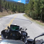
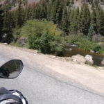
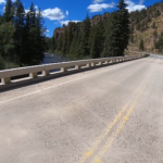
Route 742 runs from the Taylor Park Reservoir in CO and follows the Taylor River down to Almont, CO. It is a fantastic route full of nice big sweepers and the occasional slower 20mph turn, but nothing almost all riders on any type of motorcycle couldn't handle. Cruisers, Sport Touring bikes, Adv Bikes and even Sportbikes would all do well on this ride. The pavement is great and there are plenty of places to pull off next to the river for a rest or to take pictures.
1. Route 742
The Taylor Park Reservoir is a body of water created by the 1937 Taylor Park Dam, which dams the Taylor River of Colorado, United States. The dam and reservoir, located about 35 miles (56 km) northeast of Gunnison, are part of the Uncompahgre Project in Colorado. Recreation management at the reservoir is under the jurisdiction of the U.S. Forest Service and offers camping and fishing. Available fish species in the reservoir include rainbow, brown, and cutthroat trout, mackinaw, kokanee, northern pike, and brook trout in the tributaries. The summit of Cottonwood Pass lies a few miles east of the reservoir and can be accessed via Gunnison County Road 209 during the summer months.
Source: Wikipedia

Route 742 runs from the Taylor Park Reservoir in CO and follows the Taylor River down to Almont, CO. It is a fantastic route full of nice big sweepers and the occasional slower 20mph turn, but nothing almost all riders on any type of motorcycle couldn’t handle. Cruisers, Sport Touring bikes, Adv Bikes and even Sportbikes would all do well on this ride. The pavement is great and there are plenty of places to pull off next to the river for a rest or to take pictures.


