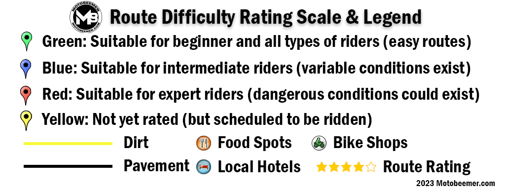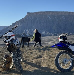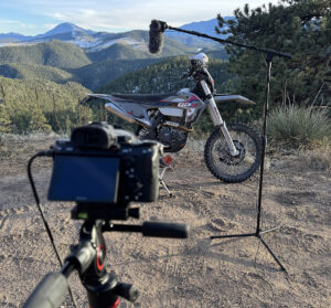
Rating Scheme Explained
More about the rating scheme. I believe most riders fall within the bell curve as they say, we are all various levels of Intermediate in some form or another. On either side of the bell curve you have your expert riders who have not only logged miles, maybe have raced or ridden in all sort of conditions for years if not decades. We don't worry too much about the expert rider being able to handle most conditions. Many of the routes I consider expert have yet to be mapped and are more hardcore off road, single track stuff.
What we are concerned with are the beginner riders on the other side of the curve. When I think of a true beginner I think of someone who just graduated their MSF course and have owned a motorcycle for maybe a month. These are the riders I think about when I rate roads, riders who are extremely prone to panic and target fixation, or locking up the brakes. When I think about roads with decreasing radius turns, off camber turns, dirt / rock and bad pavement, or even extreme shelf roads these are the type that I personally would avoid bringing a beginner rider on. I've seen it when they ride these roads, they lock up, go 20 mph under the speed limit and are absolutely terrified (sometimes they wreck). I realize this rating scheme is purely subjective but it is consistent across all routes.
**The Routes Below are Clustered, ZOOM in for your convenience to get a look at all the data. Use the SORT function below or click on an individual route or marker for more detailed information!**
Route 24
- Distance 49 miles
- Time 57 min
- Speed 51 mph
- Min altitude 5259 ft
- Peak 7507 ft
- Climb 2493 ft
- Descent 4173 ft
Cathey Canyon
- Distance 44 miles
- Time 1 h 47 min
- Speed 25 mph
- Min altitude 5384 ft
- Peak 9534 ft
- Climb 2054 ft
- Descent 5515 ft
Route 70 / 380
- Distance 101 miles
- Time 1 h 48 min
- Speed 56 mph
- Min altitude 3583 ft
- Peak 7595 ft
- Climb 5187 ft
- Descent 3996 ft
Route 246
- Distance 77 miles
- Time 1 h 30 min
- Speed 52 mph
- Min altitude 3625 ft
- Peak 6919 ft
- Climb 4944 ft
- Descent 2172 ft
Valles Caldera
- Distance 64 miles
- Time 1 h 33 min
- Speed 42 mph
- Min altitude 5479 ft
- Peak 9104 ft
- Climb 4954 ft
- Descent 5853 ft
Route 76
- Distance 22 miles
- Time 29 min
- Speed 45 mph
- Min altitude 6086 ft
- Peak 8097 ft
- Climb 1896 ft
- Descent 3274 ft
Route 518
- Distance 41 miles
- Time 52 min
- Speed 47 mph
- Min altitude 7060 ft
- Peak 9459 ft
- Climb 3510 ft
- Descent 3350 ft
Route 434
- Distance 36 miles
- Time 51 min
- Speed 42 mph
- Min altitude 7162 ft
- Peak 8816 ft
- Climb 1332 ft
- Descent 2503 ft
Taos Loop
- Distance 78 miles
- Time 1 h 51 min
- Speed 43 mph
- Min altitude 6801 ft
- Peak 9820 ft
- Climb 6194 ft
- Descent 5981 ft
Route 96
- Distance 46 miles
- Time 52 min
- Speed 54 mph
- Min altitude 6306 ft
- Peak 7907 ft
- Climb 3694 ft
- Descent 3005 ft


