- Created: July 1, 2023 8:36 pm
- Updated: November 12, 2023 11:54 pm
- Distance Instructions
- Distance 35 miles
- Time 1 h 14 min
- Speed 29 mph
- Min altitude 8028 ft
- Peak 12096 ft
- Climb 3274 ft
- Descent 4478 ft
**NOTE: Independence Pass is CLOSED for the Winter, as such the route on the map will not be reflected or be accurate. This is because this program uses a Google Maps platform. Once this opens back up in the spring the route will be reflected**
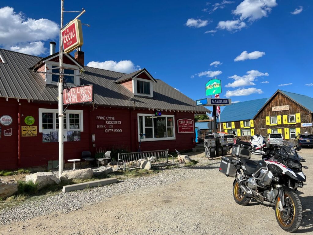
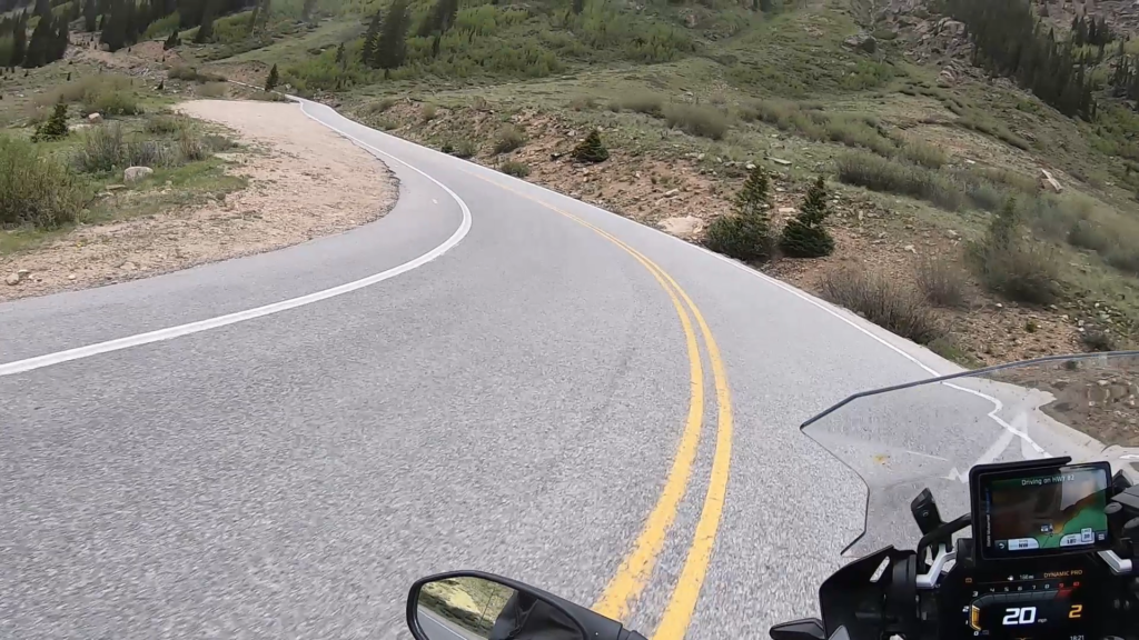
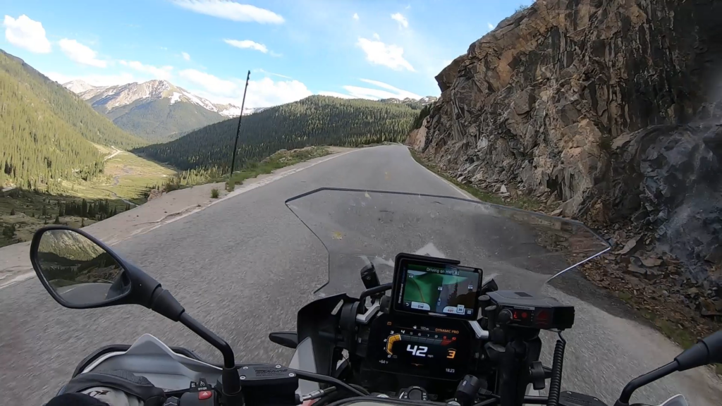
Independence Pass is a high mountain pass with an elevation of 12,095 ft, with stunning views and twisty roads that are sure to provide an adrenaline rush to riders of all types. The pass itself is around 140 miles west of Denver, CO (or 2.5 hours). The start point begins at Twin Lakes, CO, and the road winds up and over the pass, dropping into Aspen, CO.
Both sides of the pass are a great motorcycle ride, often with snow visible into June and sometimes even July just off of the road. Be aware of sheer drop offs with no guardrail in some areas, as well as small waterfalls which come from snow melts which can compromise traction. The route from Twin Lakes to the top is shorter but exhilarating, the other side that drops into Aspen does take a bit longer and the road is narrower (with some single lane areas that have stoplights).
1. Independence Pass

Independence Pass, originally known as Hunter Pass, is a high mountain pass in central Colorado, United States. It is at elevation 12,095 ft (3,687 m) on the Continental Divide in the Sawatch Range of the Rocky Mountains. The pass is midway between Aspen and Twin Lakes, on the border between Pitkin and Lake counties.
State Highway 82 traverses it, and after Cottonwood Pass to the south, is the second highest elevation of a paved Colorado state highway on a through road. It is also the second-highest pass with an improved road in the state, the fourth-highest paved road in the state and the second highest paved crossing of the Continental Divide in the U.S. Because of the heavy snowfall at its elevation, it is closed in wintertime, isolating Aspen from direct access from the east during the ski season.
When the pass is open in warmer weather, it is a popular destination. A scenic overlook near the pass allows visitors to take in the alpine tundra environment above treeline, and offers excellent views to the east of Mount Elbert, Colorado's highest peak and the second-highest mountain in the contiguous United States. Rock climbers are drawn to nearby bouldering opportunities, and informal paths lead to nearby mountain summits of even higher elevation. Backcountry skiers make use of the slopes during the late spring and early summer.
Source: Wikipedia
**NOTE: Independence Pass is CLOSED for the Winter, as such the route on the map will not be reflected or be accurate. This is because this program uses a Google Maps platform. Once this opens back up in the spring the route will be reflected**
Independence Pass is a high mountain pass with an elevation of 12,095 ft, with stunning views and twisty roads that are sure to provide an adrenaline rush to riders of all types. The pass itself is around 140 miles west of Denver, CO (or 2.5 hours). The start point begins at Twin Lakes, CO, and the road winds up and over the pass, dropping into Aspen, CO.
Both sides of the pass are a great motorcycle ride, often with snow visible into June and sometimes even July just off of the road. Be aware of sheer drop offs with no guardrail in some areas, as well as small waterfalls which come from snow melts which can compromise traction. The route from Twin Lakes to the top is shorter but exhilarating, the other side that drops into Aspen does take a bit longer and the road is narrower (with some single lane areas that have stoplights).