- Created: August 5, 2023 7:47 pm
- Updated: November 11, 2023 8:36 pm
- Distance Instructions
- Distance 45 miles
- Time 55 min
- Speed 49 mph
- Min altitude 7516 ft
- Peak 9032 ft
- Climb 4209 ft
- Descent 3064 ft
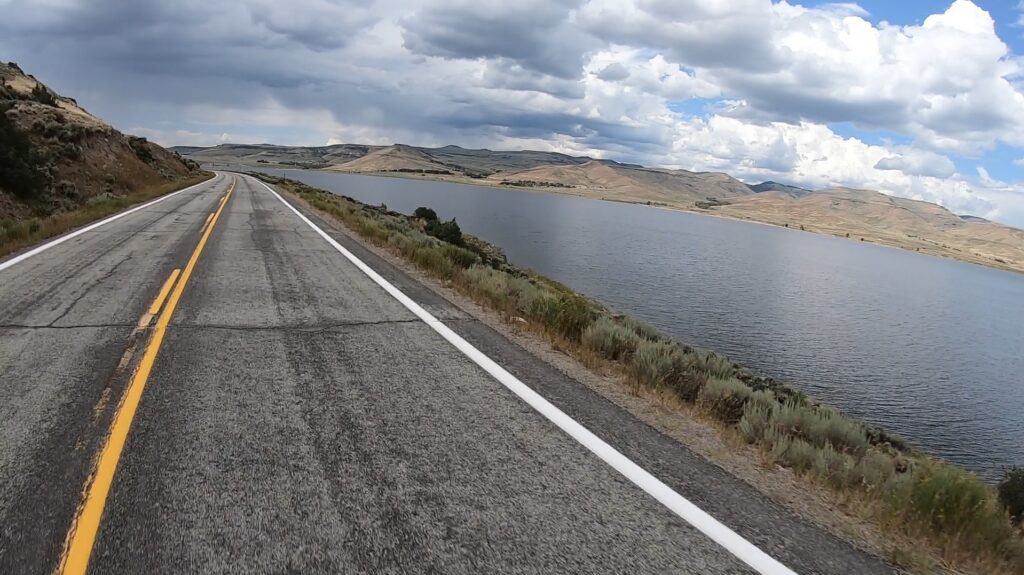
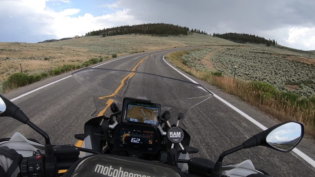
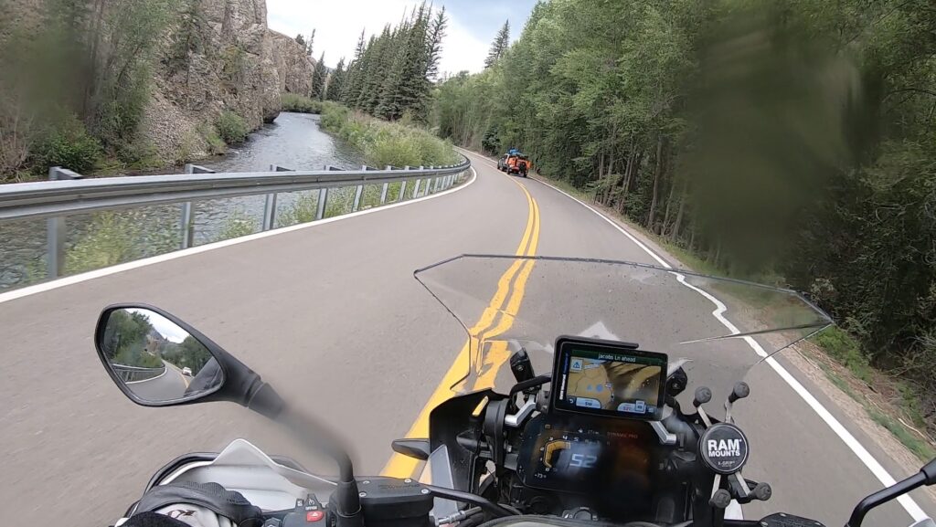
CO 149 (for the purpose of this map) is the portion of 149 that runs south from Route 50 to Lake City. It starts off with relatively straight roads (minimal turns) through some ranch areas and then winds alongside some cool gorge areas next to a river. It's a road that is not too technical and can be done by almost any rider on any type of street bike. There are a few places that are labeled as scenic lookouts which can be used for some nice photography moments.
1. CO 149
State Highway 149 (SH 149) is a 117.522-mile-long (189.133 km) state highway in southwestern Colorado, United States. SH 149's southern terminus is at U.S. Highway 160 (US 160) in South Fork, and the northern terminus is at US 50 west of Gunnison. The entire route is also known as the Silver Thread Scenic and Historic Byway.
SH 149 begins in the south at its junction with US 160 at South Fork. From there the road winds its way generally northward through the San Juan Mountains. The first portion of the road parallels the upper Rio Grande as it passes through Rio Grande National Forest. SH 149 winds through the mountains for 21 miles (34 km) before coming to the historic mining town of Creede. From there the road continues its climb into the mountains and eventually turns away from the Rio Grande to cross the Continental Divide at Spring Creek Pass at an elevation of 10,901 ft (3,323 m). At this point the road passes into Gunnison National Forest and, after a brief descent, begins an even higher climb to Slumgullion Pass elevated 11,361 ft (3,463 m). From there, the highway descends and crosses the Slumgullion Earthflow before it drops to the town of Lake City, where it begins to parallel Lake Fork, a tributary of the Gunnison River. SH 149 follows Lake Fork down out of the mountains and eventually turns away to the east passing just north of Powderhorn where the road again turns northward. After skirting the southern edge of Curecanti National Recreation Area, the highway crosses the Gunnison River and finally reaches its northern terminus at US 50 approximately nine miles west of Gunnison. There are no major junctions along its entire length.
Source: Wikipedia
CO 149 (for the purpose of this map) is the portion of 149 that runs south from Route 50 to Lake City. It starts off with relatively straight roads (minimal turns) through some ranch areas and then winds alongside some cool gorge areas next to a river. It’s a road that is not too technical and can be done by almost any rider on any type of street bike. There are a few places that are labeled as scenic lookouts which can be used for some nice photography moments.