- Created: November 1, 2023 8:47 pm
- Updated: November 13, 2023 3:25 am
- Distance Instructions
- Distance 32 miles
- Time 46 min
- Speed 42 mph
- Min altitude 7113 ft
- Peak 9951 ft
- Climb 2874 ft
- Descent 3560 ft
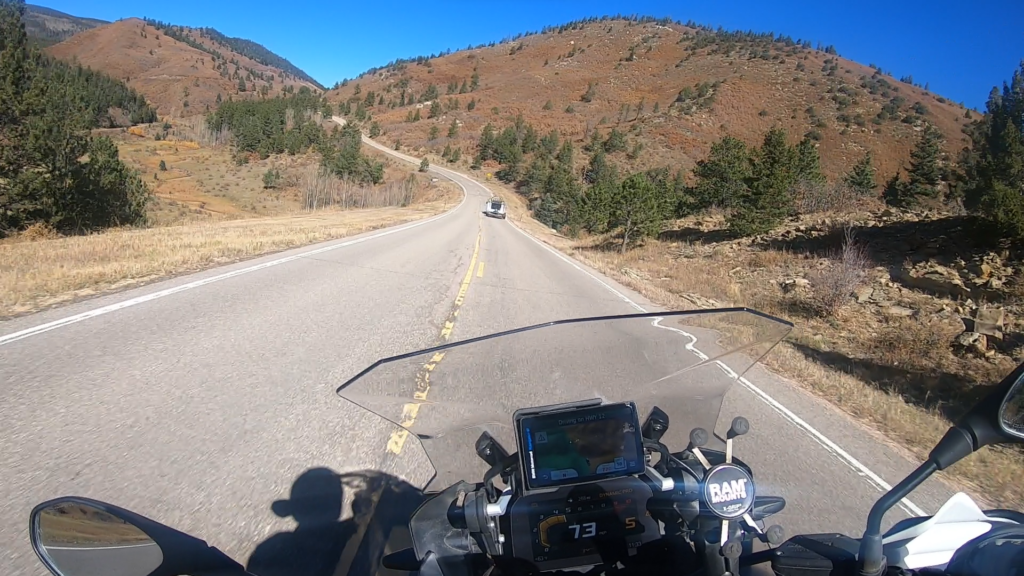
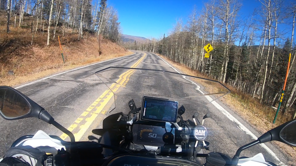
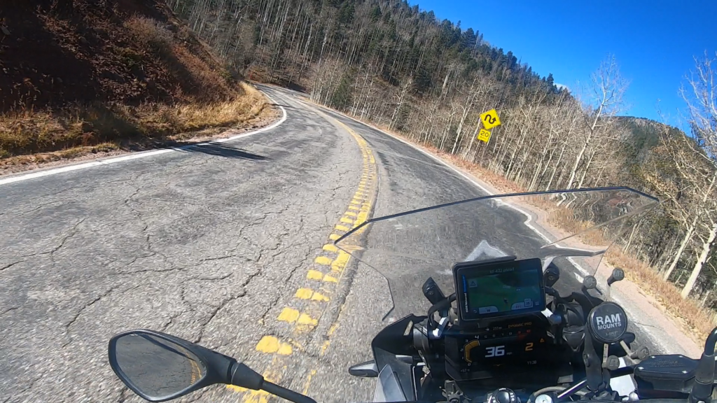
Colorado State Highway 12, or in this case 12 North (N), is the portion of 12 that runs from Stonewall up to La Veta, CO. This route has been designated differently than the portion of 12 that runs from Trinidad to Stonewall because it is firmly in the Intermediate category, with all street motorcycles being able to ride this. While it starts out pretty tame leaving Stonewall you eventually climb and then drop down into Cuchara with sequences of turns that could most definitely catch a new rider by surprise or cause them to get into trouble. Turns that drop away from you after cresting a hill, off camber, decreasing radius and switchback turns make for a challenging but fun ride. This road is out in the middle of nowhere for the most part so take caution and ensure you have good communication devices.
1. CO 12 N

SH 12 begins at the junction with U.S. Route 160 (US 160) north of La Veta. It heads southward through that town before entering the San Isabel National Forest and passing through Cuchara, near the Spanish Peaks Wilderness. It then crosses Cucharas Pass into Las Animas County.
SH 12 heads through Monument Park and turns eastward near Stonewall Gap. It then passes eastward along the Purgatoire River through Weston, Segundo, Valdez, Cokedale, and Jansen. It then ends in Trinidad at an intersection with Interstate 25, US 85, and US 87.
Source: Wikipedia
Colorado State Highway 12, or in this case 12 North (N), is the portion of 12 that runs from Stonewall up to La Veta, CO. This route has been designated differently than the portion of 12 that runs from Trinidad to Stonewall because it is firmly in the Intermediate category, with all street motorcycles being able to ride this. While it starts out pretty tame leaving Stonewall you eventually climb and then drop down into Cuchara with sequences of turns that could most definitely catch a new rider by surprise or cause them to get into trouble. Turns that drop away from you after cresting a hill, off camber, decreasing radius and switchback turns make for a challenging but fun ride. This road is out in the middle of nowhere for the most part so take caution and ensure you have good communication devices.