- Created: June 24, 2023 8:07 pm
- Updated: November 8, 2023 7:49 pm
- Distance Instructions
- Distance 23 miles
- Time 49 min
- Speed 29 mph
- Min altitude 8589 ft
- Peak 11670 ft
- Climb 3268 ft
- Descent 3241 ft
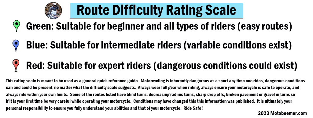
Guanella Pass is a high mountain pass with a well maintained road that runs from Grant, CO to Georgetown, CO. A ride up the pass brings you above tree line and yields fantastic views of Mt. Evans and Mt. Bierstadt, both mountains over 14,000 ft. in elevation. The start point is 58 miles or about 1.5 hours southwest of Denver, CO off of State Highway 285 although it should be noted that you can start your ride either from Georgetown or Grant, heading in either direction.
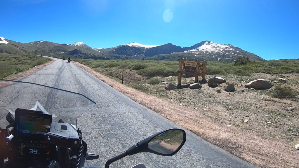
The ride up from Georgetown does have plenty of pull off's for taking pictures and is quite a bit tighter (switchbacks) but does eventually open up as campgrounds come into view. Oftentimes wildlife (mountain goats) can be seen on or near the road while exploring this side of the pass.
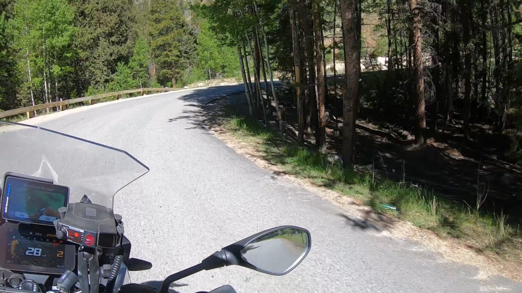
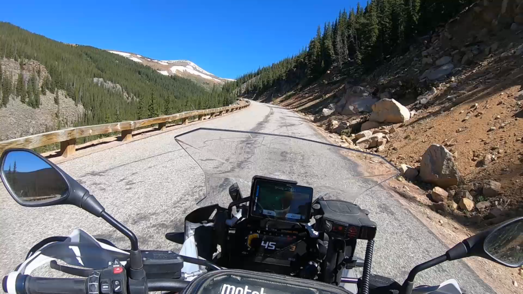
The ride up from Grant tends to be a little more fun as the turns seem to flow more (less switchbacks) and passing zones are more frequent. While there aren't as many scenic pull offs, there are a few others where one can get out and explore streams, the water rushing over the rocks at elevation and more. Moose have been encountered on the Grant side of the pass so definitely be aware.
Once at the top of the pass a parking lot and restrooms are available as well as stunning views of the mountains which surround the area. During weekends there will be cars lined up for quite some distance up and down both sides of the road leading into the parking area.
1. Guanella Pass
Guanella Pass (elevation 11,669 ft or 3,557 m) is a high mountain pass in central Colorado, in the Rocky Mountains of the western United States.
The pass is located in southwestern Clear Creek County, in the Front Range west of Denver and south of Georgetown. The pass was named in 1953 for Byron Guanella, a road supervisor and commissioner in Clear Creek County for nearly 50 years.
The pass provides a route between Georgetown in the valley of Clear Creek to the north and Grant in the valley of Geneva Creek, a tributary of the North Fork South Platte River, to the south. The pass is traversed by the Guanella Pass Scenic Byway. The road provides a link between Interstate 70 to the north and U.S. Highway 285 to the south. From Georgetown, take Clear County Route 381 south for 11 miles to the pass; from Grant, take Park County Route 62 13.5 miles to the pass.
The entire route from Georgetown to U.S. Highway 285 is paved. The road is no longer maintained in the winter and expect closure after the first heavy snow in the winter. There is a parking area at the closure gate on the Georgetown side of the pass to allow access to the pass by foot or snowmobile during the winter.
Source: Wikipedia
Guanella Pass is a high mountain pass with a well maintained road that runs from Grant, CO to Georgetown, CO. A ride up the pass brings you above tree line and yields fantastic views of Mt. Evans and Mt. Bierstadt, both mountains over 14,000 ft. in elevation. The start point is 58 miles or about 1.5 hours southwest of Denver, CO off of State Highway 285 although it should be noted that you can start your ride either from Georgetown or Grant, heading in either direction.
The ride up from Georgetown does have plenty of pull off’s for taking pictures and is quite a bit tighter (switchbacks) but does eventually open up as campgrounds come into view. Oftentimes wildlife (mountain goats) can be seen on or near the road while exploring this side of the pass.
The ride up from Grant tends to be a little more fun as the turns seem to flow more (less switchbacks) and passing zones are more frequent. While there aren’t as many scenic pull offs, there are a few others where one can get out and explore streams, the water rushing over the rocks at elevation and more. Moose have been encountered on the Grant side of the pass so definitely be aware.
Once at the top of the pass a parking lot and restrooms are available as well as stunning views of the mountains which surround the area. During weekends there will be cars lined up for quite some distance up and down both sides of the road leading into the parking area.